

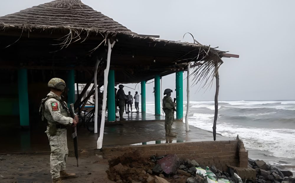
Mexico: Hurricane Polo was churning south of Mexico’s Pacific coast on Wednesday as a Category 4 storm, after an extraordinary burst of intensification saw it reach Category 5 strength.
The storm weakened slightly over the past 24 hours but remained a powerful system just offshore. According to the National Hurricane Center, Polo was moving about 165 miles south of Zihuatanejo and 320 miles southeast of Manzanillo. A sharp northwest turn was expected to begin late Wednesday and continue west-northwest over the weekend.
As of Wednesday, Polo had maximum sustained winds of 150 mph, with higher gusts. Fluctuations in intensity were expected over the next few days, but the hurricane center said the storm was expected to remain a “very powerful major hurricane.”
How Unusual Is Hurricane Polo?
Polo rapidly intensified into a Category 5 hurricane within 24 hours of forming. The last storm to intensify this quickly was Hurricane Otis, which made landfall in Acapulco, Mexico, in 2023.
At its peak Tuesday, Polo had winds of 180 mph and a central pressure of 892 millibars. The hurricane matched Hurricane Rick in 2009 for the third-highest winds ever recorded in the Pacific, behind Patricia’s 215 mph in 2015 and Linda’s 185 mph in 1997.
“This is one of the strongest storms ever in the (Pacific) Basin,” Kristen L. Corbosiero, professor at the University at Albany’s Department of Atmospheric and Environmental Sciences, told NPR.
Polo also recorded the second-lowest pressure for a hurricane in the Pacific. Since 1950, only nine of 1,088 documented hurricanes have recorded pressures below 900 millibars.
Will Polo Make Landfall?
Current forecasts indicate Polo should remain offshore, but minor shifts in its track could significantly change its impacts.
The storm is expected to produce 3 to 6 inches of rainfall, with isolated totals of up to 8 inches across parts of Guerrero and Michoacan through Thursday. Heavy rain may cause “life-threatening flooding and mudslides, especially in areas of steep terrain.”
Oaxaca, Colima and Jalisco could receive 2 to 4 inches of rain.
Where Could Polo Have The Worst Impacts?
Large swells along southwestern Mexico could bring life-threatening surf, dangerous rip currents and coastal flooding.
A tropical storm warning was in effect from Tecpan de Galeana to Punta San Telmo, while a tropical storm watch extended west of Punta San Telmo to Playa Perula.
Why Did Polo Strengthen So Quickly?
The storm was fueled in part by strong El Nino weather patterns in the Pacific. The hurricane center described Polo’s 24-hour intensification as “truly remarkable, with Polo strengthening by about 90 [knots] over that time period.”
This year’s super El Niño has been described as the most extreme on record in the source material. Warmer Pacific conditions have supported increased hurricane activity, while El Niño conditions tend to suppress hurricane development in the Atlantic.